I was always telling myself it would be a good preparation for the climb up Mt. Whitney. And I keep wondering if there will be a next time. And what was it, anyway, that drove us to get up at 3am on a Saturday morning week after week to arrive at a trailhead at the end of a long, rock-slide-prone stretch of road while the stars were still out, not yet even a hint of dawn sneaking its way over the mountains?
A passionate quest to find native lilies in bloom was how this all really got started. Gordon would do the research and off we’d go hunting. We laughingly called it “chasing butterflies” because we would often see butterflies just before spotting the lilies as if they were a signal we were on the right track.
We spent some time in the Santa Barbara backcountry and neighboring mountain areas north and south looking for all the different native California lilies we could find. And we had wonderful success.
Our search for lilies brought us to some wonderful places, and even seduced us into venturing up the highest peaks and mountains in Southern California.
As lily season ended, we wanted to keep the hiking rhythm going here in our alluring local mountains and began spending more time exploring trails and peaks in our own backyard.

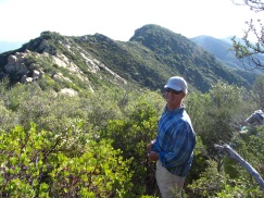
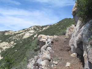
The place we call Franklin Peak
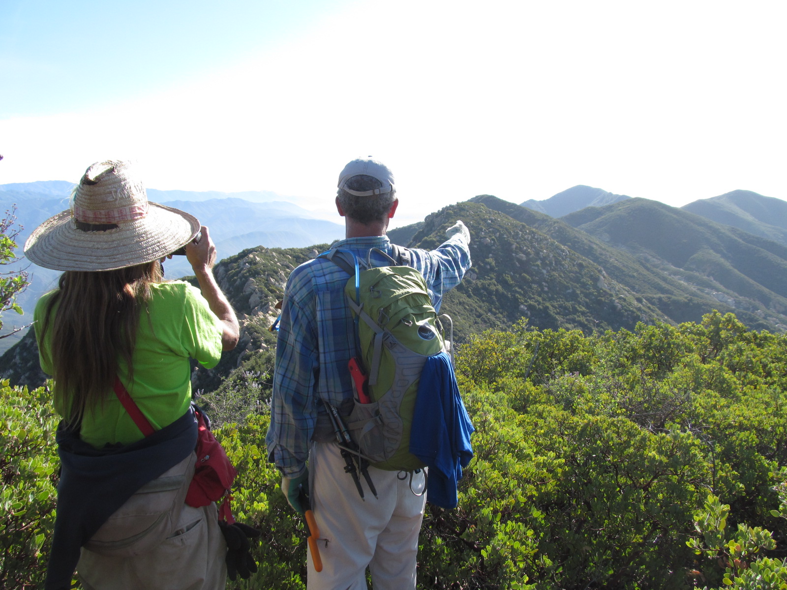
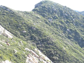
One sunny winter day in February after being inspired by a friend’s newspaper article about a hike in the Matilija area, we set out to hike up to Divide Peak via Murietta Creek in Ojai. As we ascended the Monte Arido Trail, the fog ascended right behind us. And as soon as we arrived at the end of the trail, we couldn’t see a thing, let alone Divide Peak itself!

At the end of Monte Arido Trail
We called it a day and headed back home.
Later on, we began searching for more information about Divide Peak and came across a blog showing photos of a couple of bearded adventurers and a dog, exploring an area called Kennedy Ridge with pretty much the same, soggy chilly damp conditions as we’d experienced up near Divide Peak. But what really intrigued us in this post were a couple of Los Padres National Forest archive photos from 1923, one in particular showing a westward view of a chap posing next to his horse, somewhere along the Ocean View Trail.

How great it would be, we thought, to go up there and experience this little piece of local history ourselves.
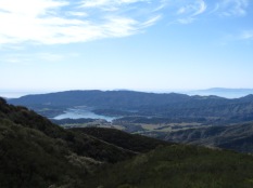
The following weekend we headed up to Kennedy Ridge where the red-bearded ones had been. And the views were amazing from up there.

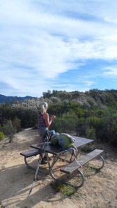
Even more amazing were the picnic tables we came upon!
We followed the trail as far as we could, about 7 miles, and returned back the same way.
Still intrigued, we searched for more information on this historic Ocean View Trail, looking to see if anyone else had written about it. We found a blog post by a woman named Diane and her adventures with Trailhacker up on the Ocean View Trail coming from the west. We set out to find the western terminus to see what that end of the trail looked like and maybe stretch it a little further.
The last weekend in February we began from Matilija trailhead sometime in the morning. We opted for the Murietta Creek Trail on the way up toward Murietta Divide.

We passed several tr ees with bear markings…
And an area where a recently fallen tree had blocked the trail.
Leaving the creek trail and continuing on up toward the divide, Gordon spotted this fox enjoying the morning sun.


Finally reaching the divide, the beginning of Monte Arido trail would have been easily missed had it not been for these rocks marking an invitation up the first of several steep sections to where the trail ends at the OHV (Off Highway Vehicle) route.

And when I say steep I am not kidding.
Words of encouragement along the way really helped me make it up that (fill in the blank) trail. And the high point of Monte Arido was finally reached.


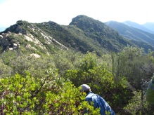
We continued onto the OHV to search for the western terminus of the Ocean View Trail.
If it weren’t for these rocks lining a “path” up the hill, we could have missed the entrance to the this trail, too. But here we found it.


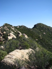
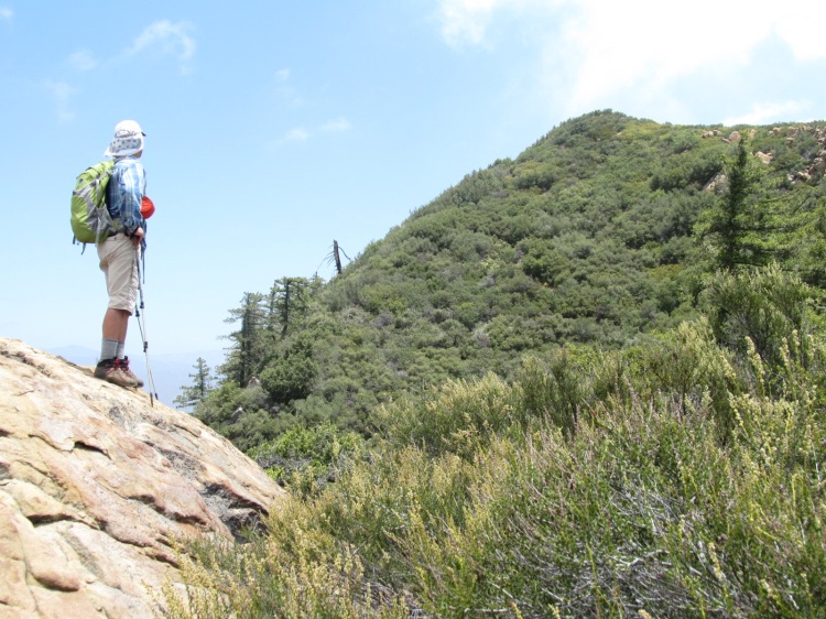
So exciting to see the landscape from a new vista.


We cleared a few hundred yards from Trailhacker’s saw location and made it back down the trail under a full moon.

Gordon beginning to clear after Trailhacker’s saw

After days of asking myself what I did to my body on that day, the fascination for the trail took over and we were already talking about going up there again on the upcoming weekend.
And we did. Hitting the trailhead at dawn and heading to a point on the Ocean View Trail where even more could be seen.
And curiosity took me off the trail a moment to make a discovery…
An old register with the last dated entry of 1993.
We continued on, cleared a little more then headed back down the OHV under a surreal late afternoon sky.
Twelve and a half hours later we were back at the trailhead for the drive home.
Already hooked, we began planning the next Saturday excursion “up the hill.” Rain and chilly temperatures brought snow to the trails going up. And it was beautiful.
Gordon worked slowly, “getting tubed in double-overhead chaparral.” 
We finally called an end to Round 3 after nearly 12 hours.
Returning the next week, I felt almost relaxed making the trip up the mountain. Bush poppies and ceanothus were in bloom and reptiles galore were sunning themselves as we made our way to where we had left off. It was a good day for Round 4.
Round 5 allowed us the pleasure of meeting the infamous Diane and Trailhacker further along on the route which stirred us in the first place. It was nice to watch how they work together, identifying and revealing the trail slowly, with integrity and care. Originally walking through the first part of the trail they cleared encouraged me to want to do the same.
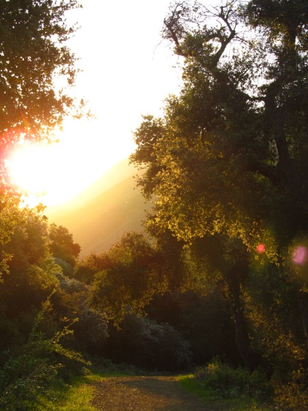
We arrived about an hour before dawn and watched the sunrise from the road up to Murietta Divide.
 .
. 
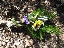
It was a peaceful morning thinking of my friend whose mother had just passed. I gathered some wildflowers on the hike up and climbed up on the ridge to place the little tribute for my friend’s mom in a nice spot with a view all the way out to Oxnard where my friend and I grew up.

While I was up on the ridge, the rocks were warming up all around, and down below Gordon began working while waiting for Trailhacker and Diane to arrive.

A short time later, I could hear voices below, Gordon and Trailhacker discussing trail direction.


As we left, Trailhacker and Diane stayed to work some more, and to spend the night up on the ridge. It was good experience to meet them.
On the way back down to the trailhead, Gordon stopped at the spring to cool off after another long day. 
Sometime during the next week, Gordon came across an old guidebook of Santa Barbara from 1913 with mention of the Ocean View Trail.
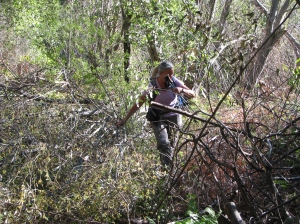
I was looking forward to Round 6, as it would be the first time being on the other side of the huge sandstone slope that the trail traverses. We made it to where we left off and began the slow process of proceeding forward, untangling whitethorn and chemise…

And a view from the other side of the sandstone slope was finally possible.

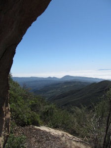
Nice trailbed was uncovered and cleared and our end point of the day was a small cave with an incredible view.

We headed down the mountain under an afternoon sky full of unusual clouds.

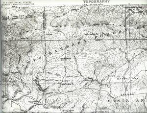
I recalled that growing up, my dad, as a civil engineer doing survey work in the area, always had maps. Now retired, I was hoping he was still hanging on to a few. And sure enough…he had several, a couple in particular catching our eye. Gordon scanned portions of a 1904 USGS topo map with 1902 survey data showing Los Padres National Forest as the Santa Barbara Forest Reserve. No Ocean View Trail, but Divide Peak is noted. The other map is from the war department from the 1940s showing the same area.

Round 7 brought us further, beautiful trail cleared with new views…
And after a couple of surprises and some hours of work, time to return home again.
On our next trip up, we were joined by a character named Millenium Twain who had all sorts of stories about the area.

And then found! The spot of the 1923 LPNF archive photo! Gordon and I spent quite a while clearing the spot to show how it looked at that time.


Clearing the trails invited creatures to explore…


We looked back at the work and headed down. A fine goal accomplished in Round 8.

After reaching the spot of the 1923 photo, the next few Saturdays up on the trail became a bit of a blur. I felt more like a machine and the trips were getting longer and longer and our packs were getting heavier and heavier with the liters and liters of water we had to carry. We got up earlier and earlier, on the trail hours before sunrise just to beat the heat and make it back in daylight. We advanced slowly and tackled a lot of very thick chaparral. Each time we finished the trailbed looks so pretty when it was cleared.
Round 9
Round 10 was full of bear signs and a switchback up toward the ridge.
Once again on the trail a couple hours before sunrise, we arrived to the ridge and began clearing over on the north side in Round 11.
Under a full moon, we began our trek for Round 12. 
This would be our 13th time up steep Monte Arido and the sunrise made this stretch easier, somehow…

It felt like it took forever to arrive at the spot where we stopped the week before. The brush was really thick and moving forward was again s-l-o-w. Still special being up there.
This would be our final round. For now.
Until next time…if there is a next time…up on the Ocean View Trail. In the meantime, we have some butterflies to chase.


")


")


")
")


")


")


")


")


")


")
")


")